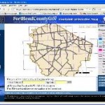
 On April 1, 2014, newly updated Fort Bend County flood plain maps will become official. This will have an immediate effect on the insurance rates paid by many property owners in Fort Bend County. The Federal Emergency Management Agency (FEMA) mapping project is an ongoing nationwide effort to update and modernize aging flood hazard maps.
County officials have worked with FEMA over the last nine years, revising and updating existing flood plain data. New technology has been used to refine elevation mapping more precisely than ever. Employing lasers, LIDAR mapping can determine land elevations within inches or less.
Property owners who find that their property has been newly designated as a flood plain may have to purchase flood insurance, which in some cases may be many times the cost of previous coverage. For this reason, property owners should confirm whether their property’s status has changed.
There is an appeal process for people who feel that the new maps are incorrect. To apply for a re-examination, application must be made to FEMA, and the property owner must pay for a survey. Survey costs are typically $500 or more, but in some cases the potential savings will make the expense worthwhile.
To view the latest version of the Fort Bend County Flood Map: Digital Flood Insurance Rate Map (DFIRM)